I have been using Google Earth satellite imagery to locate boondocking locations for at least ten years now. The images quite often show where others have camped in the past, indicated by an RV in the image, the presence of a fire ring, or both.
For the past 5+ years, Google Earth has been updating its imagery fairly often, and the resolution has been improving as well.
While the new imagery is typically more detailed than in the past, I have found that going back and looking at the “Historical Imagery” of a few years ago can be very useful in determining what is and isn’t a boondocking location and if it is accessible by my rig. Here are a few tips and tricks on how I use historical images.
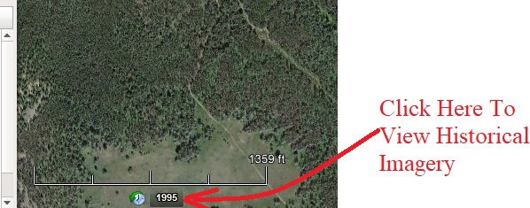 Historical imagery button – All screenshots via author (Dave Helgeson)
Through the years, the images have been taken at different times of the day. In the current image, a potential campsite might be shaded where you can’t make out the size of the space or see if there is a campfire ring, but it might be shown in full sunshine in an older historical image, allowing you to get a better look at it.
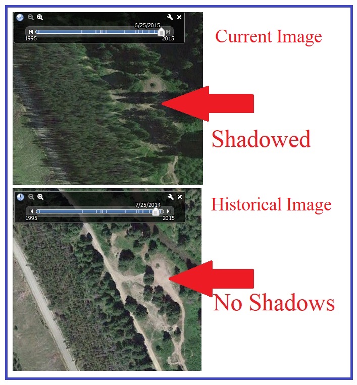 Older photos may not have shadows
The images have been taken at different times of the year, allowing you to gauge how likely the campsite might be occupied when you plan to visit. By reviewing the historical images you can see if there is someone camped in the space or not, the time of year, and with a little research, determine the day of the week. (Are certain times of the year more popular than others? Weekends more popular than weekdays?)
Historical imagery often shows different sizes and types of RVs that have occupied the site, giving you much-needed information on whether the site is accessible by your rig. If a big Class A motorhome or fifth wheel can make it to the site, my 26-foot high clearance travel trailer pulled by a 4×4 truck should have no problem.
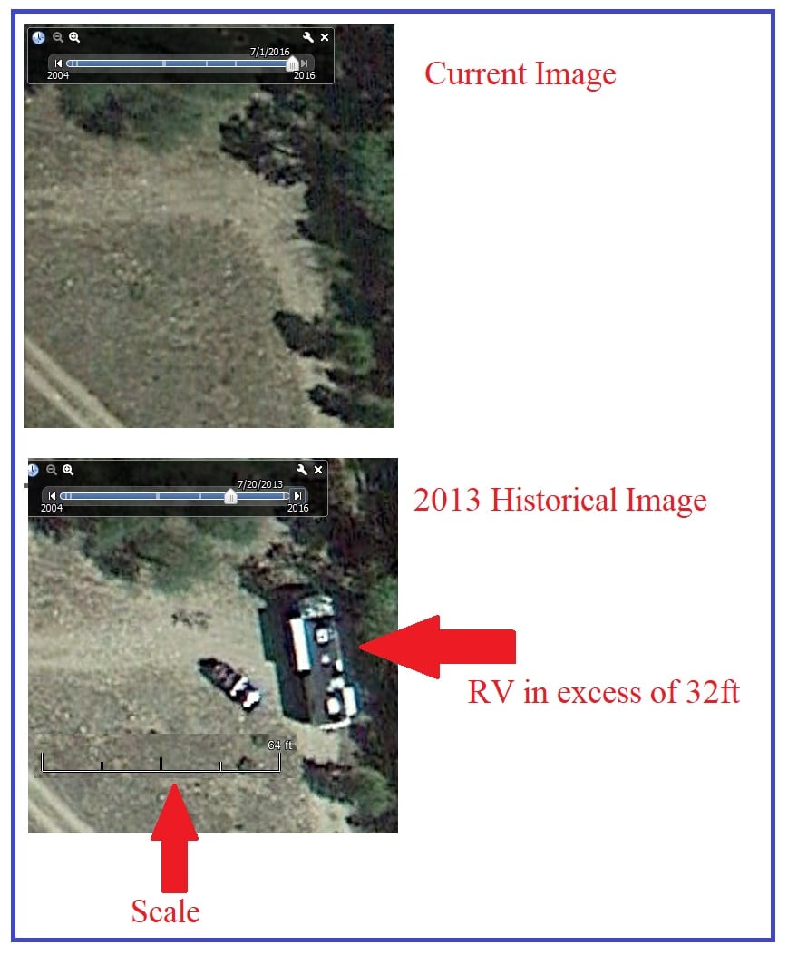 Historical imagery shows a large RV
You can see the progression of the campsite through the years. In the photo below, you can see an undefined space in the oldest image, people using the space with a pop-up canopy in the next image, and finally the emergence of a fire ring in the most recent image.
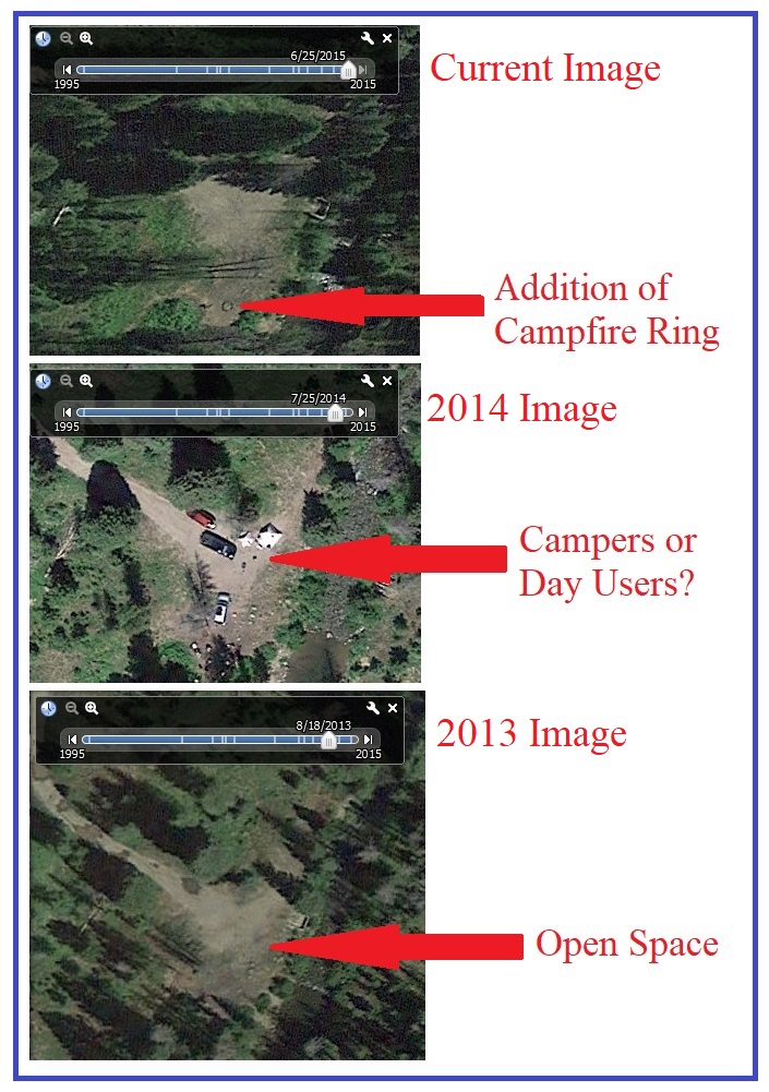
As I always say, if you can see a campfire ring on public land, I guarantee it is a legal boondocking spot as day users seldom construct a fire ring. To view the historical imagery, click on the “year” button on the bottom left corner of your laptop screen, which will display the range of years available in the top left corner of your screen.
Using historic images to find information about a boondocking site before my wife and I get there helps me avoid unpleasant adventures in RVing!
See also: 5 Boondocking Lessons: How To Camp In The Wild Like A ProThe post How To Use Historical Imagery To Find Boondocking Locations appeared first on RV Life.


