

If you have been following this blog through the years or attended one of my boondocking seminars, you know I recommend using the PublicLands.org website and/or app to determine the boundaries on federal land on which to boondock.
Lately, there have been a bunch of new apps coming out promising to be a boon to boondockers, (sorry I couldn’t resist the pun), supposedly listing thousands of places to boondock on public land.
While I have been underwhelmed by their listings (one app only shows two designated dispersed camping areas in Montana, a state which is nearly 30% federal land), I have been impressed by their overlay maps showing federal land boundaries.
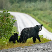
The FreeRoam app, which bills itself as “The Ultimate Source For Boondocking And Public Land Campgrounds,” does show a few dispersed campsites but what I really like about it is the overlays of USFS (United States Forest Service) and BLM (Bureau of Land Management) lands, which show much more detailed boundaries than the PublicLands site/app (see photos below).
Now I can confidently see where private land adjoins public land without having to worry that a boondocking site I have picked off Google Earth imagery is located on some farmer’s “back 40”!

A couple of other advantages FreeRoam has over PublicLands is that it contains information on all 50 states, not just the 11 western states, and it loads much faster.
The disadvantage is that it only shows USFS and BLM lands. While those two agencies control the largest amount of land open to boondocking, it doesn’t show National Monuments, Department of Defense, Bureau of Reclamation, National Wildlife Refuges, and other federal lands that allow boondocking (aka dispersed camping).
Confidently knowing whether your next boondocking site is really on federal land, just another adventure in RVing!
See also:
The post This App Makes Confirming Boondocking Spots Easier appeared first on RV Life.


